

Google Mars is a kind of Mars Google Earth, which offers the user the possibility to explore the planet without leaving home. The tool, created by Google in partnership with NASA researchers at Arizona State University, can be accessed from any browser, either on the desktop or mobile.
The initiative claims to have produced some of the most detailed scientific maps of Mars ever made. The platform is in English, but its simple interface allows for very intuitive navigation. Learn more about what Google Mars is and how to use it to know the red planet.
Google Mars has three map display modes: elevation, visible, and infrared. The first shows a relief map, which has a color legend for each altitude range. The legend can be found on the lower left singer and allows the user to estimate the altitude of what is represented on the map.
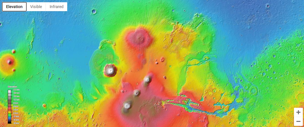
The Elevation mode was created from data from the Mars Orbiter Laser Altimeter (MOLA). The instrument, intended to create topographic maps of the red planet, belonged to the Mars Global Surveyor space probe. The instrument operated in Mars orbit between September 1997 and November 2006.
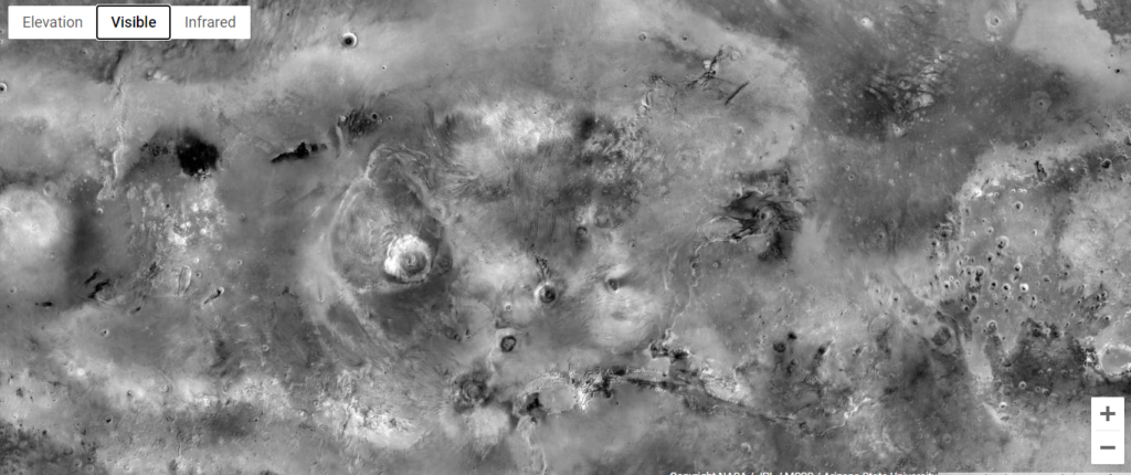
In “Visible”, the user sees the “real” appearance of Mars, captured from the orbit of the planet. As it is possible to see in the image below, the famous planet red here is gray, a color chosen by the developers to highlight more details of the surface. The photo was created with several images taken by the Mars Orbiter Camera (MOC), also from the Mars Global Surveyor probe.
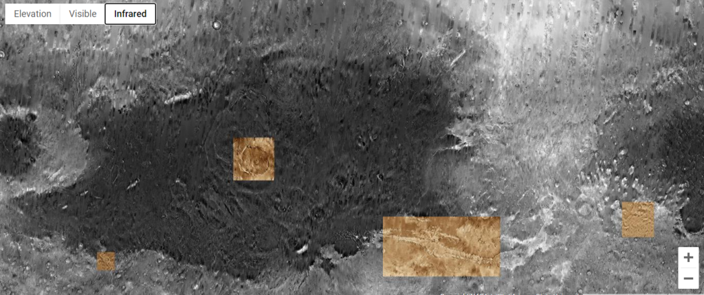
The infrared mode shows a mosaic of infrared images obtained by the Thermal Emission Imaging System (THEMIS), a Mars Odyssey feature, orbiting spacecraft since 2001. Almost two decades away from home guarantee the ship the record of longest time in orbit around another planet.
Almost all gray, the map shows warmer areas in a lighter tone and the cooler ones in dark gray. The golden parts are areas where the developers have created high-resolution mosaics by hand, so they overlap with Themis images.
Since infrared data are wavelengths invisible to the human eye, the colors are false. The choice of gold was an aesthetic preference of the creators because the shade makes high-resolution images stand out.
At the top of the page, there is a menu with geographical accidents, stories, and spaceships related to Mars. The user can browse through the topics and learn even more about expeditions and other discoveries about the planet. The options are regions, mountains, plains, spacecraft, canyons, summits, stories, dunes, and crater. It is still possible to search for a specific term in the search bar, but it is worth noting that the tool only recognizes words in English.
This post may contain affiliate links, which means that I may receive a commission if you make a purchase using these links. As an Amazon Associate, I earn from qualifying purchases.